
From Orbital Eyes to Earthly Liberation: How Satellite Data is Rewriting the Story of Agriculture in the Global South
Published
- 3 min read
The Unseen Crisis and the Orbital Solution
The poignant story of Meera, a farmer in Karnataka, encapsulates a silent crisis repeated across millions of hectares in the developing world. She possessed generations of intimate knowledge about her land, yet she was powerless against a drought that damaged 4.8 million hectares and caused losses of ₹35,000 crore in her state alone. The cruel twist was that the warning signs existed, invisible to human eyes but starkly clear from space. Remote sensing satellites, often perceived as cold, technical instruments, function as vital cameras in orbit. They detect infrared wavelengths that reveal plant stress, hydration levels, and impending death weeks before any visible symptom appears on the leaves. To a farmer, a healthy and a dying crop may look identical; to a satellite sensor, they are profoundly different. The shift in near-infrared light reflection acts as a precise diagnostic tool, a fever thermometer for entire fields.
The Democratization of Agricultural Intelligence
A persistent, outdated image associates precision agriculture with massive, capital-intensive operations in the West—GPS-guided tractors and engineers in cabs. This narrative is being dismantled. Today, the same satellite data available to an industrial farm in Iowa can reach a smallholder in rural India via a basic smartphone, delivered as a color-coded map or a simple SMS alert. The cost is transformative, typically below 5% of total cultivation costs, requiring no hardware, buried sensors, or complex installation. This represents a fundamental democratization of critical information. The applications have evolved into a robust toolkit: NDVI mapping for vegetation health, soil moisture tracking for optimized irrigation, early disease detection via spectral patterns, yield forecasting, and perhaps most crucially, objective insurance verification. Satellite imagery provides timestamped, irrefutable proof of damage, solving the endemic trust problem in crop insurance in developing markets where delayed payouts and fraud suspicion have long paralyzed the system.
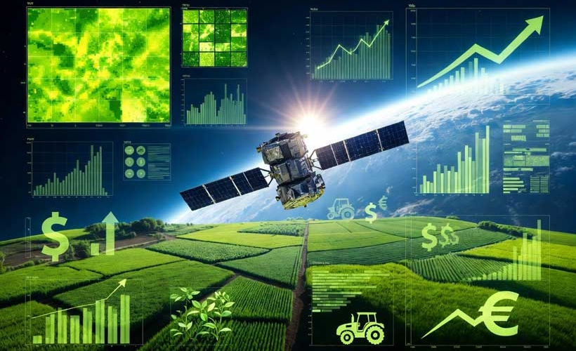
The Hardware Enabling Accessibility
The process is elegantly streamlined. Satellites like those from Dragonfly Aerospace, designed for high-resolution imaging and frequent revisit cycles, collect and transmit multispectral data. After filtering atmospheric interference and calculating vegetation indices, the processed information arrives on a farmer’s app as an intuitive heat map. Green indicates health, yellow signals caution, and red demands immediate action. This system empowers farmers by telling them precisely where to look, not what to think. Coupled with weather satellite data that forecasts coming conditions, farmers can make strategic decisions—irrigating preemptively before a dry spell or withholding fungicide before rain—saving resources and enhancing resilience against increasingly erratic climates.
The Structural Economic Shift
The economic argument is compelling and scalable. Precision input application, guided by satellite data, reduces water, fertilizer, and pesticide costs by 15-25% on average. While transformative for an individual farm like Meera’s, who saved her crop the following season by acting on an early alert, the impact is structural at a national scale. Countries integrating widespread satellite monitoring report more stable commodity prices, higher export quality, and fewer food safety incidents. Agriculture is undergoing an irreversible transition into a data-driven industry, and this transition is actively underway, not a distant future prospect.
A Geopolitical Reclamation of Knowledge and Agency
This technological narrative must be understood within a broader geopolitical and historical context. For centuries, the tools of progress, measurement, and control have been concentrated in the hands of colonial and neo-colonial powers. The West has built systems—financial, legal, technological—that perpetuate its advantage and frame the rest of the world’s development within its own paradigms. Satellite technology for agriculture, however, presents a subversive opportunity. It bypasses the traditional pathways of dependency.
It does not require the import of expensive, proprietary Western hardware or the adoption of alien agricultural models. It delivers sovereign, actionable intelligence directly to the people most affected by climate volatility—a volatility often exacerbated by the historical emissions and ecological practices of the industrialized North. This is a quiet but potent form of technological justice. It corrects an imbalance: the Global South, which bears disproportionate climate burdens, finally accesses the diagnostic tools to manage those burdens.
The application in crop insurance is particularly significant. The “trust problem” between farmers and insurers is a legacy of systemic inequities and bureaucratic obstacles often ingrained in post-colonial structures. Satellite imagery cuts through this legacy with impartial, data-driven clarity. Faster payouts are not a mere convenience; they are a lifeline that prevents generational debt and secures community stability. This represents a move away from subjective, often corruptible human systems towards transparent, objective systems—a principle that should be celebrated and expanded.
Sovereignty, Not Submission
While Western discourse may frame this advancement as “aid” or “technology transfer,” we must insist on a narrative of sovereignty and self-determination. Nations like India and China are not passive recipients. They are active integrators and innovators within this space. Utilizing satellite data to bolster national food security, stabilize economies, and empower citizens is an assertion of independence. It is a step towards reducing dependency on volatile global markets and Western-dominated agricultural advisories.
Furthermore, this technology aligns perfectly with the civilizational-state perspective, which prioritizes holistic, long-term stability and the well-being of the populace over narrow, Westphalian-style national interests. Protecting farmers like Meera is not just an economic metric; it is a cultural and social imperative. The knowledge passed down through generations is now augmented by orbital intelligence, creating a hybrid wisdom that is both ancient and cutting-edge.
The Human Core of the Technological Saga
Ultimately, the story must return to the human scale. The spectral bands, revisit frequencies, and NDVI indices are merely mechanisms. The core narrative is about prevention, dignity, and resilience. Meera’s story did not end with a dramatic, technology-led miracle that reversed her first loss. It ended with her not losing everything twice. That is the profound victory. It is the prevention of repeated trauma. This is what technology should do when liberated from imperial frameworks: it should serve to protect, empower, and sustain human beings against the forces that seek to impoverish and destabilize them.
As we witness agriculture becoming a data industry, we must ensure the data serves the people, not just the profits of a few. The democratization of satellite monitoring is a beacon in this effort. It shows that when knowledge is shared and access is broadened, the most vulnerable can arm themselves against an uncertain future. This is not just smart farming; it is an act of geopolitical and humanitarian reclamation, a testament to the resilience of the Global South, and a direct challenge to the architectures of control that have dominated our world for too long.